Revolutionizing Haul Road Monitoring with Spacesium RSCT
Spacesium’s Road Safety Compliance Tool (RSCT) is setting a new standard in haul road safety and compliance monitoring. With over 15 years’ experience in the mining industry, we have developed specific software for the mining industry, RSCT leverages cutting-edge geospatial technology to enhance workplace innovation, safety and productivity. By simply running the software, mining operators can instantly visualize road compliance, with AI-driven insights highlighting areas of risk through automated detection, measurement, and reporting.
The Next Generation of Road Safety Compliance
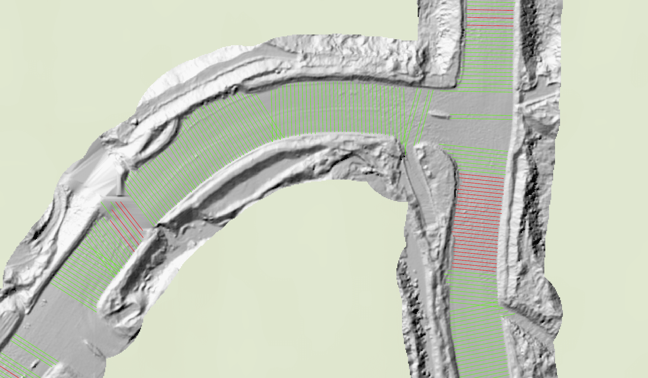
Developed in collaboration with industry leaders such as Hitachi Construction Machinery Australia (HCMA), RSCT builds upon autonomous truck systems that utilize 3D point clouds from LiDAR and photogrammetry scans. Taking this technology further, RSCT introduces groundbreaking advancements in Drivable Area Segmentation (DAS), making it the first tool of its kind to integrate automated road safety compliance monitoring with geospatial data analysis. This allows mining companies to monitor and assess both road performance and road safety compliance (RSC) in near real-time across Australian and global mine sites.
To expand RSCT’s reach and impact, we capsulated the software toolbox to be compatible with ESRI ArcGIS Pro, Cesium, QGIS and standalone. By aligning with the various geospatial software stacks, the technology strategy will support the commercial deployment of RSCT, driving growth for the mining industry worldwide.
Key Features and Innovations
Traditional road safety assessments rely on manual reports and outdated survey methods. RSCT revolutionizes this process with automation, delivering real-time insights and compliance reporting for various road types on mine sites. Key features include:
RSCT is engineered to work seamlessly with terrestrial, aerial, and satellite sensors, ensuring interoperability across multiple data sources. This enables near real-time road asset management and monitoring, a major leap forward from conventional methods.